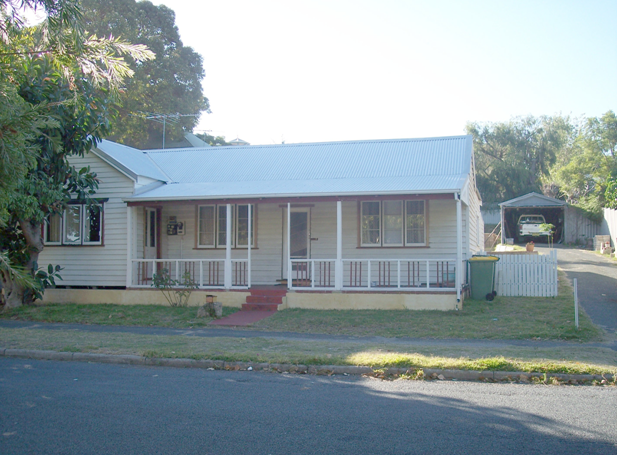
Alcester Street
In September 1883 Stephen Henry Parker and James Morrison of Perth commenced subdivision of 65 acres of land to the north of Canning Road. The subdivision occurred at Swan Locations 63, 176, 219 and the south western portion of Swan Location 306. The subdivision included Preston Point Road, Alcester Gardens, Wolsely Gardens, Victoria Road, Alexandra Road, Parry Avenue, and Salvado Avenue.
The Richmond Precinct was owned by Walter Easton and was named after the town of Richmond where Easton lived in England. In 1901 Easton’s sons subdivided Windsor Estate. New streets to the subdivision of the Windsor Estate were named after various members of the Easton family; Walter, Gill, Stratford and Morgan (later Osborne Road). Initially lot sizes were generous but sold at a slow rate. The initial development of the Richmond Precinct occurred at Canning Highway and Preston Point Road. Substantial residences were developed on these streets.
By 1913 there were approximately 40 residences in the area between Preston Point Road and Alexandra Road. Osborne Road, Windsor Road and Gill Street had several buildings apiece by 1913. By 1931 approximately half the lots were developed. In 1921 Richmond Primary School was developed between Windsor and Osborne Road and several Inter-War residences were developed in the immediate area. In the 1930s the Workers’ Homes’ Board developed a number of weatherboard, asbestos, brick and tiled residences. Inter-War style front porches were preferred over Federation style full width verandahs.
Redevelopments have occurred throughout the Richmond Precinct. Large lot sizes have allowed Richmond to be subject to the redevelopment of group and multiple housing. However, significant clusters of heritage dwellings remain throughout.
Search for a property
Tip: You can search for an entire street, a specific street address, architectural style, responsible architect or a family name.


